Göcek Mooring Buoy Project — What It Is, Technical Details & 2026 Plans
This page provides a comprehensive guide to the Göcek Mooring Buoy Project, covering technical design, environmental impacts, 2026 bay-based deployment, and implications for gulet, motor yacht, and yacht charter operators. All references to Platinyachting services are included for operator and guest guidance.
1. Project Overview — What the Göcek Mooring Buoy Project Is
The Göcek Mooring Buoy Project integrates modern mooring hardware (buoys) with mapping and monitoring systems, enhancing safe navigation, environmental protection, and sustainable tourism. Its primary objectives are:
- Positioning and marking: Smart buoys with GPS, AIS, and LED lighting placed around bays and islets for safe navigation.
- Environmental monitoring: Sensors collect data on water quality, currents, and marine life for real-time monitoring and mapping.
- Tourism and management: Demarcation of sensitive areas, optimization of gulet, motor yacht, and general yacht traffic.
The project is a critical step in sustainable tourism and maritime safety in Göcek, supporting Blue Cruise operations and local ecosystem management.
Why “Mooring Buoy” and “Mapping” Are Integrated
The combination of hardware (buoys) and data (mapping) allows real-time management. Modern smart buoys include GPS, AIS, water-quality sensors, and remote telemetry, all integrated into mapping dashboards. This enables faster decision-making for authorities and operators.
Technical and Engineering Details
- Buoy Hardware Layer: Static and smart buoys (GPS + AIS + telemetry), solar-powered, LED lighting for day/night visibility.
- Materials: HDPE resistant to marine conditions, stainless connectors, UV-coated surfaces.
- Power: Solar panels with lithium battery backup.
- Communication: 4G/5G-ready modem, LoRa or satellite uplink in critical areas.
- Sensor Layer: Measures temperature, pH, dissolved oxygen, turbidity, microplastics, and current speeds.
- Mapping & Data Layer: Cloud-based dashboards with real-time panels, historical data archives, alerts, and API access for marinas, municipalities, and maritime safety authorities.
- Management & Integration: AIS/map integration, route alerts, digital marking of protected zones (no-anchor/no-wake areas).
Installation and Maintenance Steps
- Site survey and bathymetry: Ensures stable buoy placement; includes analysis of Blue Cruise routes.
- Hardware selection and testing: Checks cellular coverage, energy needs, and sensor types.
- Deployment: Anchoring and stabilizing; rescue and accessory planning to prevent losses.
- Integration and mapping: API connections and AIS system syncing.
- Maintenance cycle: Annual servicing; sensor calibration recommended every six months.
Environmental Impacts and Ecosystem Benefits
- Protected area monitoring: Real-time data helps prevent anchor damage to Posidonia meadows and sensitive seabeds.
- Water quality tracking: Early detection of oil or chemical spills.
- Biodiversity studies: Long-term data provides species distribution and migration patterns.
- Climate contribution: Sea temperature trends feed global climate models.
Note: Benefits depend on correct placement, data sharing, and collaboration with municipalities, biologists, local residents, and yacht operators.
Maritime Traffic, Safety, and Charter Operator Advantages
- Enhanced route planning: Real-time currents and depths optimize fuel efficiency and comfort. See Gulet Charter and Motor Yacht Charter pages.
- Safety alerts: Storms, high traffic, and hazard notifications reduce response times.
- Location-based tourism services: Guests receive updates about nearby bays and safe mooring spots, integrated with Blue Cruise itineraries and Göcek Yacht Charter resources.
Operator Guidelines
- Include buoy coordinates in route planning and test compatibility.
- Update onboard GPS/AIS systems.
- Inform clients of protected zones during booking — see Charter FAQ.
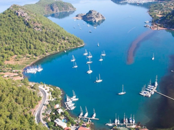
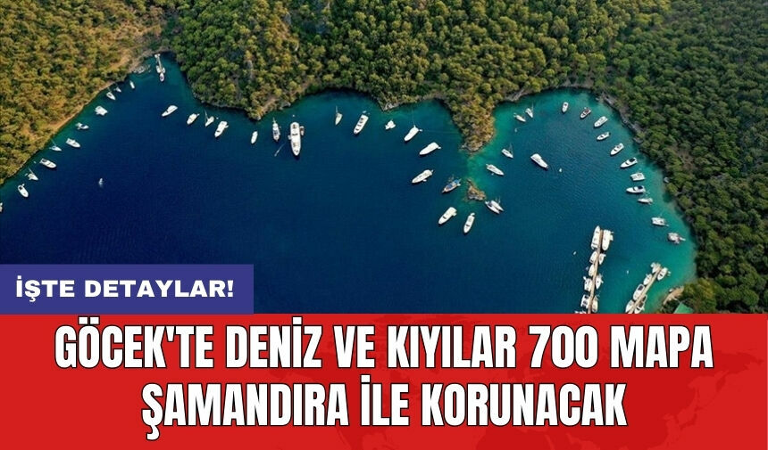
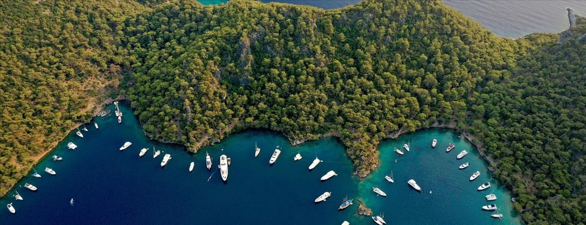
Göcek Mooring Buoy Project 2026 — Bay-Based Deployment
The 2026 plan aims to protect Göcek’s marine environment while supporting a safe and organized anchorage system for gulets, motor yachts, and trawlers.
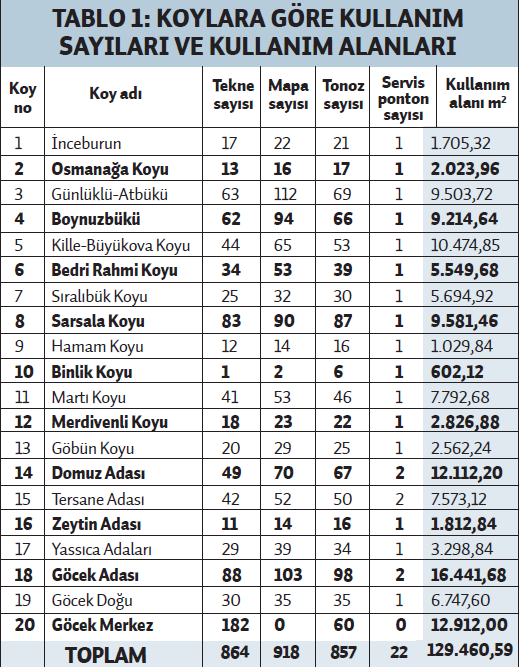
| Bay | Planned Buoys | Maximum Vessels | Notes |
|---|---|---|---|
| Bedri Rahmi Bay | 35 | 35 | Environmental priority; pilot installations here. |
| Boynuzbükü | 28 | 28 | Pilot testing with floating platforms and sensors. |
| Sarsala | 30 | 30 | Family-friendly mooring; expected seasonal increase. |
| Yassıca Islands | 22 | 22 | Reserved for small gulets and day-trip boats. |
| Göbün | 18 | 18 | Suitable for vessels 15–20m. |
| Kille | 20 | 20 | New eco-friendly chain-mooring system applied. |
Total buoys: 153. Expected simultaneous vessels: ~150–160. This supports yacht charter guests and sustainable anchorage management.
2026 Timeline
- Pilot deployment (late 2025–early 2026): 10–20 smart buoys installed in selected bays.
- Assessment & revisions (Q2 2026): Sensor calibration and communication updates based on collected data.
- Full deployment (late 2026): Expansion across all designated bays; potential regulatory anchoring restrictions enforced.
Expected Outcomes for Operators & Tourists
- Public dashboards for transparency.
- New certifications for sustainable blue cruise operators.
- Operators offering eco-conscious charter packages to guests.
Projected Vessel Numbers & Impact Scenarios
Three scenarios for peak season 12-week period:
- Conservative: 50 vessels/week → ~600 season → ~900–1,200 annual affected.
- Medium: 100 vessels/week → ~1,200 season → ~1,800–2,400 annual affected.
- Optimistic: 200 vessels/week → ~2,400 season → ~3,000–4,000 annual affected.
Vessel Type Distribution
- 60% — Gulet & charter yachts (Gulet Charter)
- 25% — Motor yachts and private yachts (Motor Yacht Charter, Yacht Charter)
- 15% — Day-trip, diving, and commercial vessels.
Short-Term Operational Benefits
- Reduced anchoring damage via demarcation.
- Optimized routes reduce fuel consumption — ~5–10% average savings per operator.
- Faster intervention in environmental violations due to shared data.
FAQs
- How many vessels will be directly affected?
- Depending on scenario: 50–200 vessels/week, 600–2,400 seasonally, 900–4,000 annually.
- How many vessels support pilot operations?
- 5–8 support and technical vessels: 2 crane-barges, 2–4 monitoring boats, 1–2 security boats.
- Are these figures final?
- No — season intensity, area coverage, and regulations may change outcomes. Regular updates on charter prices and pilot reports recommended.
- Will buoys prevent gulets from anchoring?
- Protected zones are clearly marked; alternative mooring points provided for operators.
- Does this affect charter prices?
- Short-term operational costs may occur; long-term fuel and safety efficiencies balance costs.
- Who can access data?
- Authorities and project stakeholders; public dashboards recommended for transparency.
Charter Operator Integration
Operators should include updated buoy coordinates in itineraries and guest materials. Relevant pages:
- Gulet Charter (Standard, Luxury, Deluxe, Ultra-Luxury, Yoga & Private options)
- Motor Yacht Charter & Trawler Charter
- Regional & route pages: Bodrum, Fethiye, Marmaris, Göcek
Pricing and route planning resources: Gulet charter prices, Yacht charter prices, and Blue Cruise FAQ.